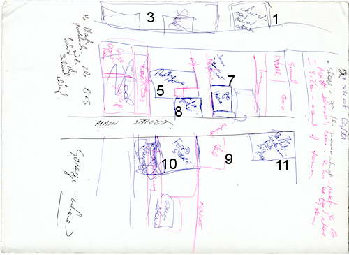
When I started to write this book, I had a vision in my head of Farwell Creek, based on the town of Bowenville, where I grew up. But the Creek isn’t Bowenville, so I decided very early in the writing process that I was going to have to map it out. I’m no artist, but everyone in the bush knows how to draw a ‘mud map‘.
I started with the main road and the pub – the two most important features in any bush town. As I introduced the characters in the book, I gave them homes… BUT…
Every book goes through a process of writing and re-writing. I quickly realised that I needed Bec to be able to see the school from her house. The answer – I moved the school. Likewise, the garage shifted to the other end of town… for a scene which I later edited out of the book.
In the drawing – the blue sketch is the original… the pink bits are the corrections I made about two months into writing the book.
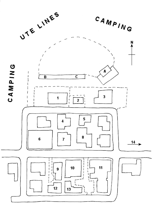
As I continued to live in Farwell Creek with Bec and Hailey and Nick, the town became so firmly fixed in my mind, that I didn’t need to keep updating the map. So – webmaster John read the final text and came up with a true map of Farwell Creek – as it really is according to the book.
It’s quite some way from my original – but what did not change was the nature of the town and the people who live there. As someone once said of me – you can take the girl out of the bush, but you can’t take the bush out of the girl. Moving the occasional house will never change the nature of a bush town – or the people who live there.

KEY
| 1 | Church | 7 | Post Office | 13 | Baxter House |
| 2 | Teacher’s Cottage | 8 | Police Station | 14 | Price Farm |
| 3 | School | 9 | Shop | Ball Site | |
| 4 | O’Connell House | 10 | Feed Store | A | Stage |
| 5 | Tate House | 11 | Farwell Creek Hotel | B | Souvenirs |
| 6 | Garage | 12 | Ryan House | C | Refreshments |

